|
El Nino >>
|
3.5 - The Thermohaline Circulation
Objectives:
- To understand that the Gulf Stream is part of a global system of water movement.
- To understand the process that drives the thermohaline circulation.
- To be able to describe the key parts of the project to monitor the Thermohaline Circulation (RAPID MOC).
- To know the potential consequence of a slowdown in the Thermohaline Circulation.
The surface currents are only part of the overall picture. Water also moves vertically - ascending and descending, and so there are currents in the deep ocean as well. These are density driven currents set up by what is happening at the surface. It was discovered that all of these currents can be considered together as a global circulation known as the THERMOHALINE CIRCULATION.
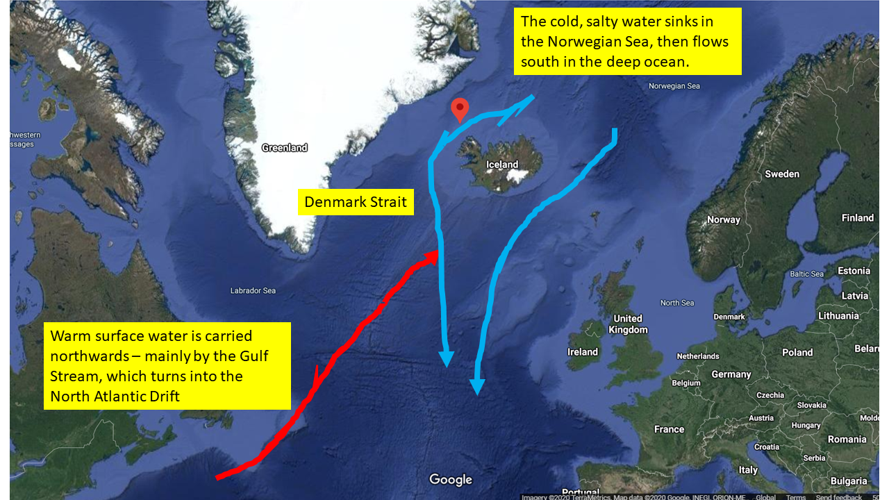
The driving 'pump' for this occurs in the far north. As the warm water is driven north, mainly by the Gulf Stream, it cools down. Fresh water is lost due to a combination of evaporation and ice formation. The water becomes colder and salter, which both lead to the density increasing. This water sinks mostly in the Norwegian Sea - just north of Iceland and the Faroe Islands. When it reaches the bottom it has to go sideways, which effectively means south as it pools up at the bottom in a large basin. By far the largest waterfall in the world is underwater at the Denmark Strait between Iceland and Greenland. The continental shelf drops off as a cliff here, and the water cascades unseen down it and heads southwards.
The name thermohaline comes from heat (thermal) and salinity (haline), as the circulation is driven by both of these changes.
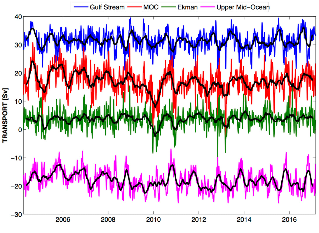
Climate Change - it is predicted that the Thermohaline Circulation will slow down due to global warming. The consequence of this would be a cooling of the climate in Northern Europe as less warm water would arrive to moderate the winter temperatures. Other consequences may be a rise in the sea level for the east coast of the US and Canada. In 2004 a monitoring array of moorings was set up across the Atlantic at \(26^{\circ}\text{N}\) to measure the amounts of warm water flowing north and cold water flowing south. The RAPID MOC array measures how the vertical density profile across the Atlantic change and from that it can deduce the density driven currents. The surface components can be measured by satellites that can determine the surface wind speed and directions. The flow of the Gulf Stream through the Florida Straits can be measured using the voltage induced by the salt water flowing across disused telephone cables connecting the Bahamas with Florida! Lots of physics in ocean science....
|
|
|
|
The most recent data from the NERC RAPID array that is measuring the overturning circulation across the tropical North Atlantic Ocean - a key indicator in the strength of the Thermohaline Circulation.
|
|
|
|
|
ACTIVITIES
- LAB - Thermohaline Model
- LAB - freezing seawater, measuring salinity changes
El Nino >>