5.6 - Satellites (Remote Sensing)
Satellites orbiting high above the Earth's surface play a surprisingly important part in environmental science. Most obviously they can be used to measure the sea surface temperature (SST) and charting the coastlines, but they can also be used to measure the surface wind velocities and the surface salinity.
There are two types of orbit that a satellite can occupy: polar or geostationary orbits. Polar orbits are just above the atmosphere and so are great for measuring detail, but they move far faster than the Earth rotates. They move across the surface at a blistering rate of 8 km/s. Geostationary satellites orbit at the same rate that the Earth rotates, so that they keep pace and appear to stay in the same location above the surface, but to achieve this they need to be located 36,000 km above the equator. These are too far away to be able to see much detail, but can see the entire disc of the Earth. Great for large scale communication and global weather imagery.
There are two types of orbit that a satellite can occupy: polar or geostationary orbits. Polar orbits are just above the atmosphere and so are great for measuring detail, but they move far faster than the Earth rotates. They move across the surface at a blistering rate of 8 km/s. Geostationary satellites orbit at the same rate that the Earth rotates, so that they keep pace and appear to stay in the same location above the surface, but to achieve this they need to be located 36,000 km above the equator. These are too far away to be able to see much detail, but can see the entire disc of the Earth. Great for large scale communication and global weather imagery.
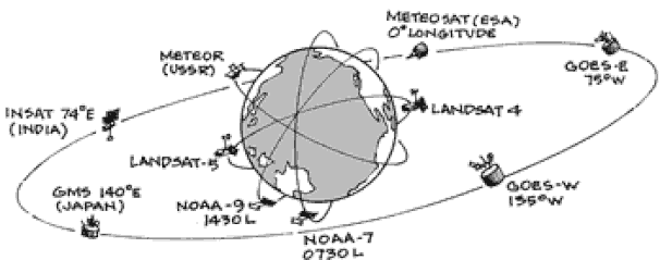
Image showing the different orbits. Landsat and NOAA satellites are in polar orbits while the GEOS and INSAT satellites are in geostationary orbit above the equator. Not to scale.
|
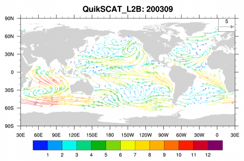
Near surface wind vectors colored by wind magnitude for September, 2003. (Climate Data Guide; D. Shea)
|
|
|
Polar orbits, also known as Low Earth Orbits (LEO), effectively scan the surface of the Earth as the planet rotates under them. The advantage is they can cover a wide area in great detail. However, not all at once. If a research program has a LOT of money, it is possible to send up more satellites that can fill in the gaps and reduce the temporal resolution of the data.
A well-known example of this type of satellite was QuikSCAT, which bounced microwaves from the ocean surface. The reflection of these microwaves would be different depending on the wind driven waves. After calibration, this data was then used to determine the surface level wind speed and direction, which was then used for research and weather forecasting. |
|
Another ocean variable that is useful for weather forecasting and measuring the surface currents is the Sea Surface Temperature (SST). This can be done from space by measuring the infrared radiation emitted from the surface. Infrared or thermal radiation is emitted from all warm objects. The warmer the object is the shorter the wavelength of the infrared radiation.
Unfortunately, cloud cover tends to reflect most of this radiation back to the surface, and this effect coupled with the clouds radiating out their own infrared radiation tends to mean that the data is not always measurable. For example, the imagery from the 7th April 2020 shows the Gulf Stream as warm water, but the white areas have no readings due to cloud cover. Bermuda is just at the bottom edge of the image. |
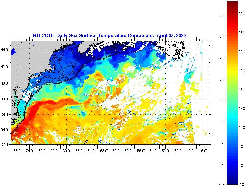
Image of the SST of the Western Atlantic clearly showing the Gulf Stream. (Image: Rutgers University and NASA)
|
Other Resources
Surface Drifters