|
Oceanography >> The World Ocean >> Plate Tectonics
|
Seawater >>
|
1.5 - Plate Tectonics
Objectives:
- To know and recall the basic structure of the Earth and that the plates are floating on the mantle.
- To understand that the plates have created the ocean basins.
- To understand that interactions between plate boundaries allow for outgassing and the recycling of minerals and elements.
- To know that the longest mountain range in the world is the Mid-Atlantic Ridge.
Scientists have long realised that the Earth was not a solid ball of rock. Firstly, there was the rather obvious evidence of volcanoes spewing molten lava from their craters, which immediately raised the potential for the Earth to have a hot molten core underneath the ground. Secondly, the vast majority of the rock that makes up the crust and lava is not magnetic and yet the Earth has a pretty strong magnetic field. Thirdly, the density of rock is roughly \(2.8\,\text{g/cm}^3\) and the mean density of the Earth as a whole was found to be much higher than that.
The nail in the coffin of the solid Earth theory came with the science of seismology and the transmission and reflection of pressure waves through the Earth's various layers and boundaries.
The nail in the coffin of the solid Earth theory came with the science of seismology and the transmission and reflection of pressure waves through the Earth's various layers and boundaries.
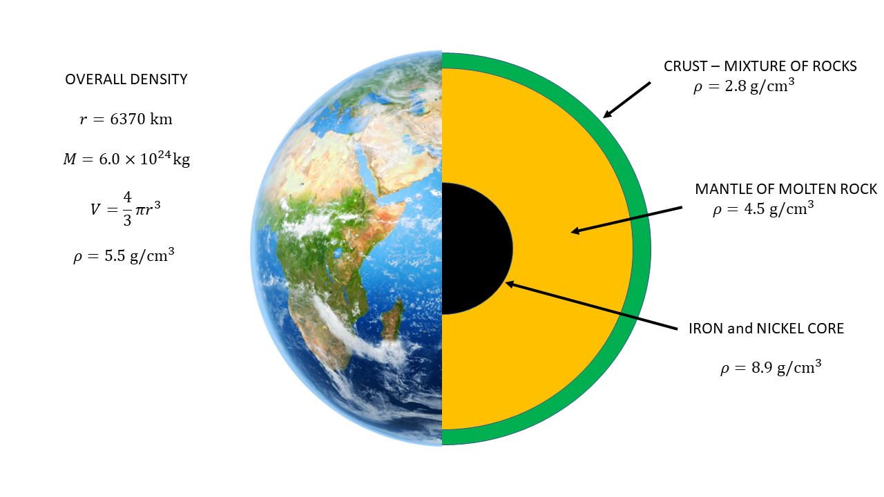 Simplified cross-section of the Earth showing how the density of the different parts increase as you go deeper into the planet. In effect, the less dense material 'floats' on the denser material.
A quick inspection of a map of the world has sent many school students wondering if Africa should fit into South America. Geologists hunted down fossils and rock types and found matches that hinted that once upon a time the various continents were joined together. Alfred Wegener drove the theory on to more solid ground (so to speak) when he realised that convection currents under the crust would cause the parts of the crust to move and collide. Where the plates collide and interact produces volcanoes and earthquakes.
The rock cycle form part of this puzzle. Volcanoes and other underground activity spew forth IGNEOUS rocks such as granite, obsidian, basalt and pumice. The heat and pressure from this activity can transform existing local rock into METAMORPHIC rocks such as marble, quartz and slate. The water cycle erodes these rocks and transports them down rivers until the fragments are deposited as a sediment, which is compressed over time to form SEDIMENTARY rocks such as sandstone, shale and limestone. These eventually will end up subducted back into the mantle to be melted down again. The ultimate slow recycling system.
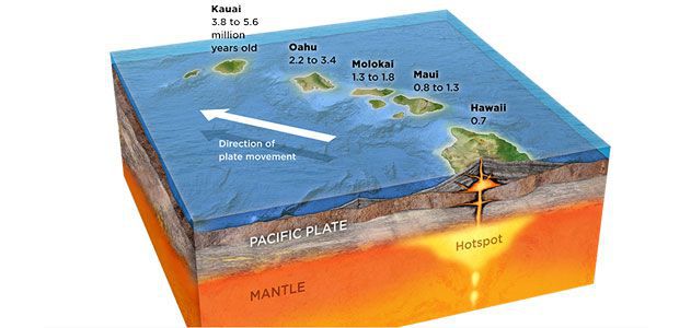
Under the ocean, there is a huge mountain range formed from underwater volcanoes, the Mid-Atlantic Ridge. Bermuda sits upon a long dead volcano. Hawaii was formed over a weak spot in the Earth's crust.
The rock cycle form part of this puzzle. Volcanoes and other underground activity spew forth IGNEOUS rocks such as granite, obsidian, basalt and pumice. The heat and pressure from this activity can transform existing local rock into METAMORPHIC rocks such as marble, quartz and slate. The water cycle erodes these rocks and transports them down rivers until the fragments are deposited as a sediment, which is compressed over time to form SEDIMENTARY rocks such as sandstone, shale and limestone. These eventually will end up subducted back into the mantle to be melted down again. The ultimate slow recycling system.
Under the ocean, there is a huge mountain range formed from underwater volcanoes, the Mid-Atlantic Ridge. Bermuda sits upon a long dead volcano. Hawaii was formed over a weak spot in the Earth's crust.
|
Formation of the Hawaiian archipelago. As the Pacific plate moved over the hot spot, volcanoes erupted to form the islands. (Image from the Smithsonian Magazine.)
|
|
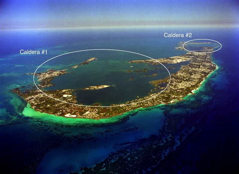
Formation of Bermuda - NOAA article on Bernews. The island is formed from sedimented remains that sit on top of a long dead volcano that must have once been over a hot spot. The top of the eroded volcanic plug is at least \(75\,\text{m}\) below sea level. There are rumours that some traces of volcanic basalt can be found at Bailey's Bay, but I have never seen them.
|
|
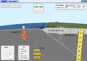
PhET Simulation of Plate Tectonics. Need Java to run.
|
|
|
|
ACTIVITIES
- Using Google Earth to view the bathymetry and location of hydrothermal vents.
|
Worksheet
|
| ||
Seawater >>